| UPPER PETTIBONE LAKE ICE HOUSES |
|---|
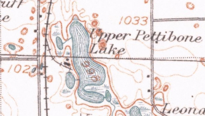
As this 1909 USGS topographic map shows, there was once a long railroad siding which branched off the main line, approximately one-half mile south of Clyde, and curved southeast toward the west shore of Upper Pettibone Lake. Although long since abandoned and torn up, traces of the roadbed are still visible in aerial photographs of this area. More curious still, the siding is still shown on some maps, such as those found on Google, although it has not existed for years! This lengthy siding was built so that blocks of ice harvested from the lake could be shipped by rail to Detroit and other cities. There they would be sawn into smaller blocks and sold to cool the ice boxes once found in many household kitchens.