| The Village Of Spring Mills |
|---|
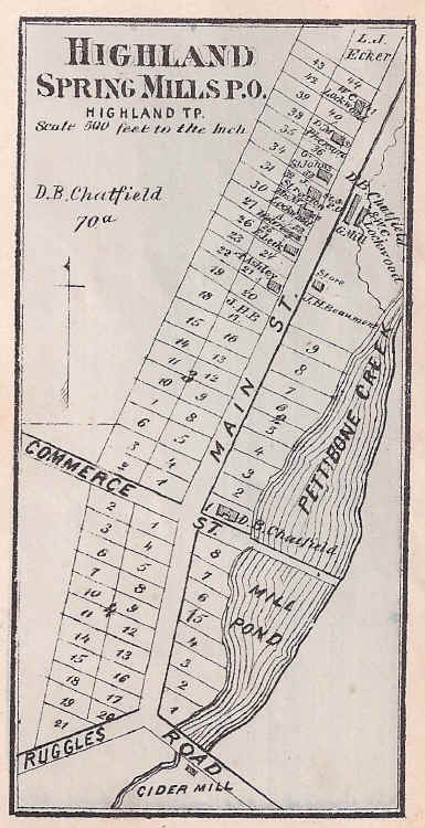
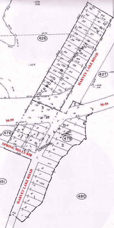
This is a side-by-side comparison of the 1872 map of Spring Mills with a modern parcel map. Notice that "Main St." is now Harvey Lake Road, while "Commerce St." is Spring Mills Road (since abandoned). "Ruggles Road" was a lane which once veered off north from East Livingston Road and ran across a bridge over the dam for the lower water power. As can be seen, modern M-59 now cuts through the heart of Spring Mills. The "Lockwood & Dunham's Addition" to the village, in the northwest part, was platted in May, 1859. The first house in the village was built in the summer of 1846, on Lot 2 of Block 2, on the northeast corner of Main Street (Harvey Lake Road) and Commerce Street (Spring Mills Road). Block 4, in the southwest corner, was never developed or built upon and the plat for this section of the village was "vacated" around 1980.