| EAST HIGHLAND |
|---|
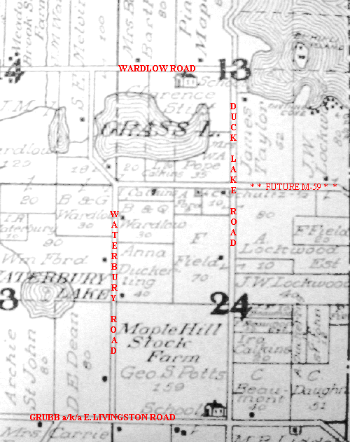
For more than a century after Highland Township was established, the intersection of Duck Lake Road with what was originally the western end of Elizabeth Lake Road remained little more than a sleepy country crossroads. As can be seen on this portion of a map of Highland from the 1908 Standard Atlas Of Oakland County, George A. Ogle & Co., Chicago, the area was essentially surrounded by farms. The only real "development" anywhere in the area was at the south end of White Lake, where summer resort cottages had begun to spring up. All this quickly changed in the late 1930's, however, when this portion of old Elizabeth Lake Road was paved and incorporated into M-59.