| 1831 BURR MAP OF MICHIGAN |
|---|
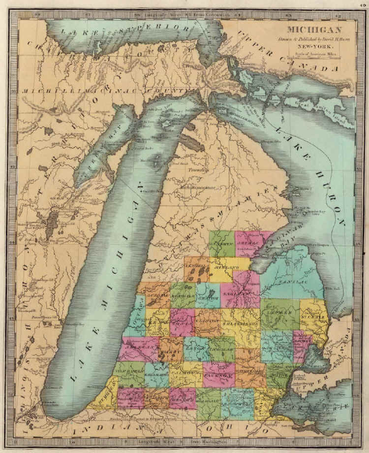
One of the earliest maps to show Oakland County in any detail was David H. Burr's map of Michigan, seen here. While the map itself is dated 1831, it was not published until 1835 when included in A New Universal Atlas; Comprising Separate Maps Of all the Principal Empires, Kingdoms & States Throughout the World, D.S. Stone, New York (1835). Note the State's almost "straight" western shore along Lake Michigan; an error common to Michigan maps of this period. Note also that Genesee and Livingston counties had not yet been established. Instead, what is now Genesee was still part of Lapeer and the eastern part of Shawassee counties, while Livingston was divided between southern Shiawassee and northern Washtenaw counties.