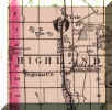
BACK
TO MAIN PHOTO TOUR PAGE
BACK TO
THE HISTORICAL RECORDS AND REFERENCES PAGE
These Maps Are Listed By Date. Scroll Down To View Them
All.
Introduction:
Understanding The Michigan Baseline
And Meridian Survey System
![Baseline_Meridian.jpg (421365 bytes)](Baseline_Meridian_small.jpg)
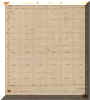
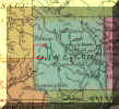
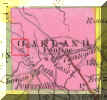
1823 Government Survey
Of Highland Township
![highland_survey.jpg (290626 bytes)](highland_survey_small.jpg)
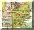
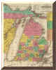
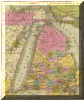
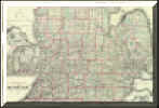
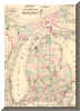
1831 Map Of Michigan With
Oakland County Detail
![1831_Burr_Detail_Outline.jpg (284457 bytes)](1831_Burr_Detail_Outline_small.jpg)
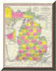
1833 Map Of Michigan With
Oakland County Detail
![1836_Tanner02.jpg (40839 bytes)](1833_Tanner_Outline_small.jpg)
1839 Map Of Michigan With
Oakland County Detail
![1839_Tanner_Map.jpg (202055 bytes)](1839_Tanner_Outline_small.jpg)
1840 Map Of Michigan
With Oakland County Detail
![1840_Greenleaf_Outline.jpg (284945 bytes)](1840_Greenleaf_Outline_small.jpg)
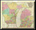
1847 Map Of Michigan
With Oakland County Detail
![1847_Mitchell02.jpg (332476 bytes)](1847_Mitchell02_small.jpg)
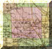
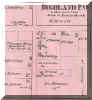
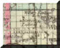
1872 Map Of Highland
P.O. (West Highland)
![1872West_Highland.jpg (55115 bytes)](1872West_Highland_small.jpg)
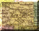
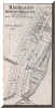
1872 Map Of
Highland Centre (Highland Station)
![1872Highland_Centre.jpg (69053 bytes)](1872Highland_Centre_small.jpg)
1872 Map Of Highland -
Spring Mills P.O.
![1872Spring_Mills.jpg (50924 bytes)](1872Spring_Mills_small.jpg)
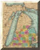
1873 Map Of Lower
Michigan With Highland Detail
![1873_Chapman02.jpg (3221 bytes)](1873_Chapman02_small.jpg)
1873 Railroad Map Of
Michigan With Highland Detail
![1873_Railroad_Map02.jpg (169735 bytes)](1873_Railroad_Map02_small.jpg)
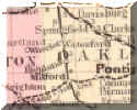
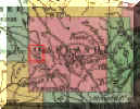
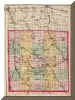
1873 Atlas Of
Oakland County With Highland Detail
![1873_Whaling_Detail_small.jpg (2918 bytes)](1873_Whaling_Detail_small.jpg)
1909 USGS Topographic
Map (Highland Portion)
With Enlargements Of The NE, NW, SE And SW Quarters
![1909_USGS_Full.jpg (686653 bytes)](1909_USGS_Full_small.jpg)
1928-29 Oakland County
Road Map (Highland Portion)
![1928-29_Map.jpg (309433 bytes)](1928-29_Map.jpg)
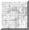
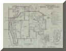
Highland Township Plat
Map (Circa 1940-45)
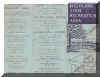
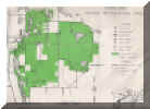
![1940highland.jpg (506816 bytes)](1940highland_small.jpg)
Highland State
Recreation Area Map
& Brochure (Circa 1945)
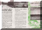
![Highland_Rec_Map002_big.jpg (2776652 bytes)](Highland_Rec_Map002_big_small.jpg)
Highland State
Recreation Area Map
& Brochure (Late 1940's)
![Highland_Rec_Map004_big.jpg (78277 bytes)](Highland_Rec_Map004_big_small.jpg)
1956 Highland Township
Plat Map
![1956 Highland Plat Map.jpg (4456603 bytes)](1956_Highland_Plat_Map_small.jpg)
|