| THE MICHIGAN BASELINE AND MERIDIAN |
|---|
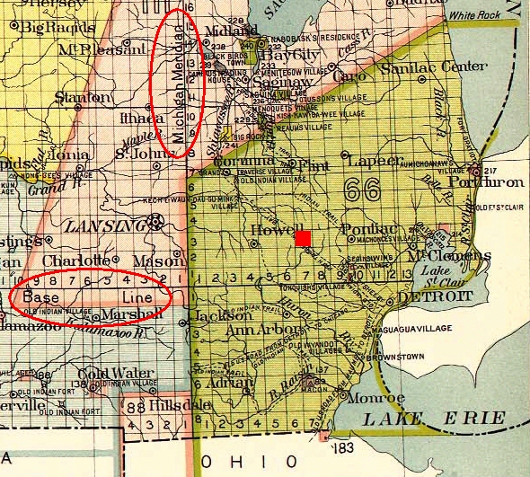
Highland Township's "official" designation is "Township 3 North, Range 7 East." The first part of this description means that Highland is the third township north of the "Michigan baseline" - an east-west line surveyed by Alexander Holmes in 1815. This is essentially the line followed by 8 Mile Road, which in some communities is actually called "Baseline Road." Likewise, the second part of this description indicates that Highland is the seventh township east of the "Michigan meridian" - a north-south line surveyed in April 1815 by Benjamin Hough. This meridian was selected because it formed the western boundary set forth in the 1807 Treaty of Detroit in which the native tribes ceded land east of a line running due north from the mouth of the Auglaize River on the Maumee River; the site of Fort Defiance, now Defiance, Ohio. This line passes through and gave its name to Meridian Township, Ingham County, Michigan. The map below is a portion of that published in the Bureau of American Ethnology, 18th Annual Report (1899), Plate CXXXVI, with both the Michigan baseline and meridian circled in red. The red square shows Highland as the third township north and seventh township east of these principal survey lines.