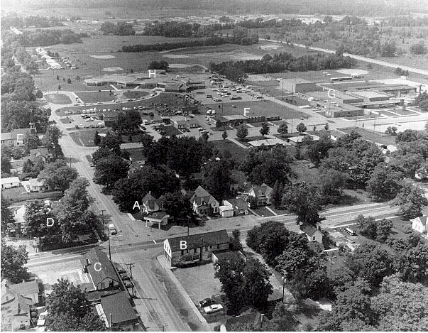
| "Downtown" Highland Station |
|---|
This is an aerial view of Highland Station looking west, taken circa 1980. Centre Street (Milford Road) runs from left to right, while Livingston Road runs from bottom left to top left. Among the buildings visible are: (A) The Asa Smith home and Mobil filling station; (B) the Needham Building, which replaced the Keller and Waterbury store; (C) the rebuilt Hulbert store, since demolished and now a small township park; (D) the Highland Centre House; now the Highlander House; (E) the Highland Methodist Episcopal Church; now the Highland Station House; (F) the current Highland Township office complex, which includes the former 1957 post office; (G) Highland Middle School; and (H) Highland Elementary School.