| 1833 TANNER MAP OF MICHIGAN |
|---|
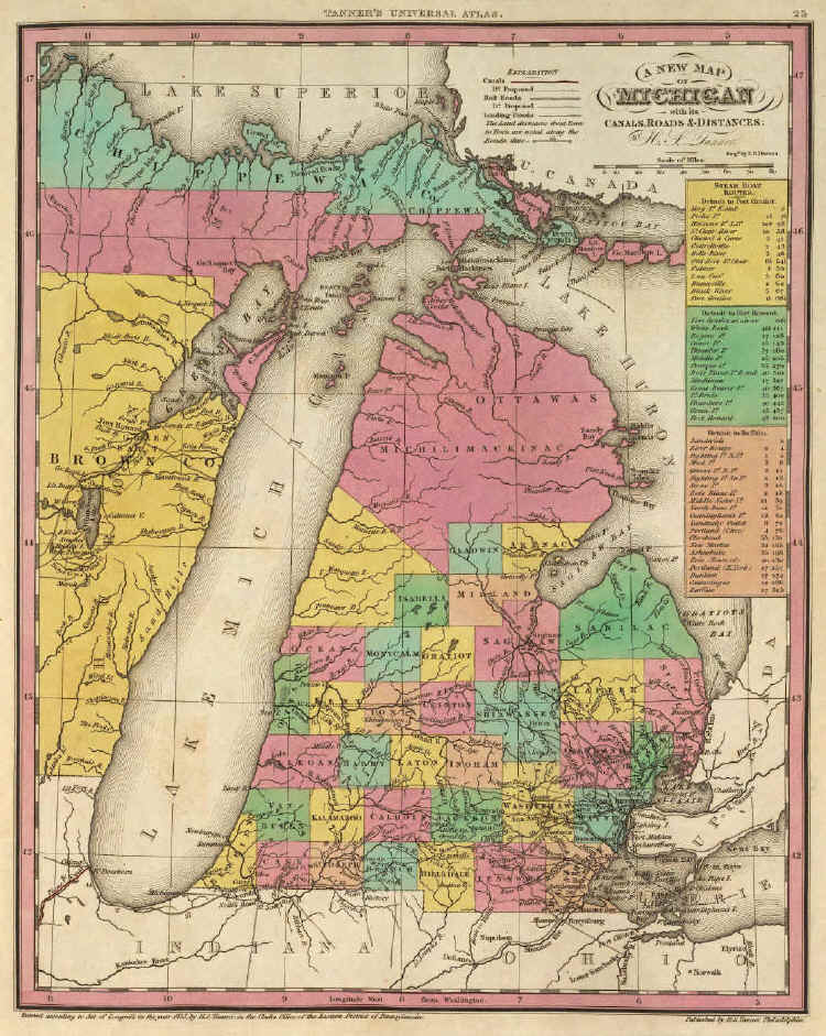
Two years after Burr's 1831 map, Henry S. Tanner drew A New Map Of Michigan With Its Canals, Roads & Distances, "entered" (copyrighted) in 1833 and eventually published as part of his New Universal Atlas Containing Maps Of The Various Empires, Kingdoms, States and Republics Of The World, With A Special Map Of Each Of The United States, Philadelphia (1836). Like Burr, Tanner gives a distorted view of the state's Lake Michigan coastline. So too, Genesee and Livingston counties are still not shown.