| 1833 TANNER MAP OF MICHIGAN |
|---|
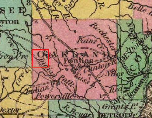
This is an enlargement of the Oakland County portion of Tanner's 1833 map, with the area comprising Highland outlined in red. White Lake is visible more or less in its proper position. Unlike Burr, however, Tanner shows it draining north into the Shiawassee River; an error repeated on several subsequent maps. Tanner also adds details not found on Burr's 1831 map, i.e., two "Indian Paths" passing through what would become Highland Township. The path in the southwest is the "Shiawassee Trail", while that in the northeast is sometimes called the "White Lake Trail;" since incorporated into modern Rose Center and White Lake Roads. For more on the history of Highland's Indian Trails, click here.